Shop : Details
Shop
Details

April 2017
Tobias Busse
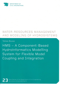
HMS – A Component-Based Hydroinformatics Modelling System for Flexible Model Coupling and Integration
Software integration in hydroinformatics is challenging and the proposed solutions are often very project specific. Attempts have been made to overcome this problem, but further effort is needed. The aim of this work is to develop an approach that simplifies software integration in hydroinformatics. Current modelling software was analysed and common requirements were identified. It is argued that component-based architecture founded upon a generic metamodel, in which the components, their behaviour and their relations are specified, would overcome fundamental problems.
To prove this hypothesis, a modelling system has been developed that is based on a metamodelling framework. It combines numerical process simulation with geospatial data analysis and enables flexible model coupling and integration. A layer concept was introduced, whereby a layer is a representation of an autonomous subsystem. Layers reduce the complexity of the overall system while keeping specialised knowledge encapsulated and accessible to others. The behaviour and state of a layer can be altered by means of specific implemented algorithms, whereby generalised element mapping and data transformation of interacting layers are provided.
The modelling system was successfully employed for hydroinformatics applications, whereby specific layers for the simulation of surface flow, tracer transport and the analysis of geospatial data have been realised. Applications include: the adaptive simulation of coupled processes, the software integration of distributed simulation systems, the simulation of a contaminant spreading within an urban river, a dam break scenario and the simulation of a rainfall-runoff event within a small alpine catchment.
Keywords: water engineering; hydroinformatics; software integration; component-based; meta modelling; framework
Heftreihe des Instituts für Bauingenieurwesen / Book Series of the Department of Civil Engineering, Technische Universität Berlin
Edited by Prof. Dr.-Ing. Matthias Barjenbruch, Prof. Dr.-Ing. Karsten Geißler, Prof. Dr.-Ing. Reinhard Hinkelmann, Prof. Dr.-Ing. Wolfgang Huhnt, Prof. Dr.-Ing. Yuri Petryna, Prof. Dr.-Ing. Frank Rackwitz, Prof. Dr. sc. techn. Mike Schlaich, Prof. Dr.-Ing. Volker Schmid, Prof. Dr.-Ing. Matthias Sundermeier and Prof. Dr.-Ing. Frank U. Vogdt, Berlin
Volume 23
Export of bibliographic data
Shaker Verlag GmbH
Am Langen Graben 15a
52353 Düren
Germany
Am Langen Graben 15a
52353 Düren
Germany
Mon. - Thurs. 8:00 a.m. to 4:00 p.m.
Fri. 8:00 a.m. to 3:00 p.m.
Fri. 8:00 a.m. to 3:00 p.m.
Contact us. We will be happy to help you.

