Shop : Details
Shop
Details

June 2015
Norman Mattern
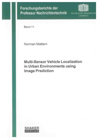
Multi-Sensor Vehicle Localization in Urban Environments using Image Prediction
The work describes novel measurement models for the localization of vehicles in urban environments. The system utilizes different sensors which are mounted to a vehicle: A gray scale camera, vehicle motion sensors and a GPS receiver. Moreover, digital maps are used as additional source of information. The innovation of the presented method is in the novel kind of incorporation of the image data delivered by a camera sensor into the process of estimating the vehicle's position. In contrast to state-of-the-art approaches, the models proposed by the author are able to include entire image areas instead of only distinct features limited in terms of space. The approaches use different means of representing the digital map data. On the one hand, data equivalent to standardized map databases can be utilized. On the other hand, aerial images can be used as well.
The presented approaches are evaluated using real-world data. For this purpose, measurements were provided by a test vehicle and an extensive test drive. The results of the algorithm are compared to a ground-truth reference. It is shown that the approach proposed by the author can achieve lane-level accuracy of the position information in urban environments using the given sensors. This enables new kinds of applications, at the same time keeping the costs for such system feasible.
The presented approaches are evaluated using real-world data. For this purpose, measurements were provided by a test vehicle and an extensive test drive. The results of the algorithm are compared to a ground-truth reference. It is shown that the approach proposed by the author can achieve lane-level accuracy of the position information in urban environments using the given sensors. This enables new kinds of applications, at the same time keeping the costs for such system feasible.
Keywords: Aerial Images; Bayesian Filtering; Digital Maps; Image Prediction; Landmarks; Vehicle Localization; Vehicle Positioning
Forschungsberichte der Professur Nachrichtentechnik
Edited by Prof. Dr.-Ing. Gerd Wanielik, Chemnitz
Volume 11
Available online documents for this title
You need Adobe Reader, to view these files. Here you will find a little help and information for downloading the PDF files.
Please note that the online documents cannot be printed or edited.
Please also see further information at: Help and Information.
Please also see further information at: Help and Information.
| Document |  | Document | ||
| Type |  | |||
| Costs |  | 36,60 € | ||
| Action |  | Purchase in obligation and download the file | ||
| Document |  | Table of contents | ||
| Type |  | |||
| Costs |  | free | ||
| Action |  | Download the file | ||
User settings for registered online customers (online documents)
You can change your address details here and access documents you have already ordered.
User
Not logged in
Export of bibliographic data
Shaker Verlag GmbH
Am Langen Graben 15a
52353 Düren
Germany
Am Langen Graben 15a
52353 Düren
Germany
Mon. - Thurs. 8:00 a.m. to 4:00 p.m.
Fri. 8:00 a.m. to 3:00 p.m.
Fri. 8:00 a.m. to 3:00 p.m.
Contact us. We will be happy to help you.

